The Apuan Alps

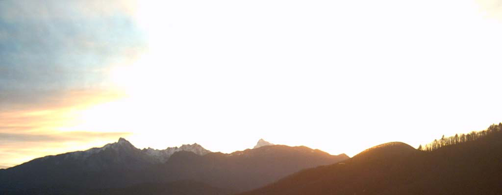
The Apuan Alps are a mountain range located in northern Tuscany, between the rivers Magra (northwest) and Serchio (southeast), which declines to the south-west with the Versilia and the Apuan Riviera and north-east with valleys of Lunigiana and Garfagnana.
The adjective "Apuan" comes from the fact that in ancient times were inhabited by Ligurian Apuani.
 The Apuan Alps by Marco Marando
In the late nineteenth century, Gustavo Dalgas, one of the most authoritative members of the Florentine section of the CAI, in his article "Pania della croce" defines the Apuan Alps "A miniature of the Alps."
An expression very effective framework for a range of mountains whose morphology is similar in many ways impressive mountain chain, which has earned the title of the Napoleonic era in the Alps, in contrast with the more rounded profile of the nearby Apennines, there are in fact mountain peaks, towers, pyramids, walls sharp.
During the Quaternary there was also a fairly glacial activity, despite the proximity of the sea, with its mitigating effect on the air, they soften the texture.
The largest glacier in "Val Serenaia" extended, in the northern sector of the chain, with 6.5 km in length in a spectacular amphitheatre of peaks: "Pizzo d'Uccello" (m 1781), "Gondilice" (m 1805) "Contrario" ( m 1789), "Cavallo" (m 1899) and "Pisanino" (m 1945).
Another valley track which gives clear idea of the connotation of the Alpine massif is the Valley of the Hotels, which comes to lap the foot of the magnificent south face of Mount "Contrario", while in the distance Mount "Cavallo" show for entire its tail, dominated by the unique shape of the "Carina" peack. Way towards to the centre of the mountain chain are also other peaks that exceed 1700 meters: "Tambura" (m 1890), "Roccandagia" (m 1700), "Sumbra" (m 1764) and "Pania della Croce" (1859 m) and clearly visible to those rooms by South northwards, almost near the coast, stands the isolated "Monte Sagro" (1749 m), which as the name suggests, was to have been a sacred place for the first inhabitants.
The carsick nature of these mountains has created in them a tangle of pipes, caves, tunnels that open sometimes in sudden salt produced from the corrosive action of water percolating: only those who have the ability to venture into this world apart can admire its amazing architecture. In addition to caves known as the "Grotta del Vento", the "Buca d'Equi" (where he stayed prehistoric man) and "l'Antro del Corchia", there are several depths, deep and narrow wells originated when vehement tectonic movements have caused fractures.
The record of depth in the Apuan Alps and in Italy it's for the "Roversi", in the region of "Carcaraia"; discovered by Bologna's cavers in the seventies, , accurate and final measurement (-1350 m) there was only 25 years later, thanks to the exploration of Florence's colleagues.
Enclosed in an area of just over 1000 sq. km., The Apuan Alps, especially along the sea side, are divided into the deep valley gorges where the sun is in hiding for several hours each day. Less harsh and more wooded slope appears the Apennines, where you can see groups of mixed oaks, hornbeam, alder, hazel, chestnut, and from 900 m, beautiful beech forests. This discrepancy between the two sides has resulted in microclimates often conflict, which gave rise to a rich variety of plant species: among these relics of past ages some endemic here, confined in some oasis, were allowed to continue their precious lives.
Walking along over 500km of trails that go up, down, around, intersect an infinite landscape and offer more and different perspectives, not least the one that has as its background the sea, is a feature that few other mountain groups can afford. And at stake there is always the magic of surprise, is that our presence are ancient trees, or strawberries and their unmistakable perfume rejoice that our passage.
The strong anthropization and exploitation of the mountain, which was necessary to feed generations of people, forced by the nature of an ancestral territory and relentless poverty and the presence of a railway line that runs around the mountain range and basins the production of hydroelectric power, have given way to the precise limits to the demarcation of the Park of the Apuan Alps. Established in 1985, actually came into force on 11 August 1997. Even in this they differ from the Apuan Alps park concept in the traditional sense, which is conceived as a kind of impenetrable fortress where nature is the absolute queen, and where you come home to tens of kilometres.
Here it is not, so that the people in a protected area of the Park of the Apuan Alps are about 20000, including urbanized areas contiguous.
A mountain range very complex, despite the limited size ... both in width, and height.
The locations of the shelters in the park offers a range of mountains optimal use the articles: ease of access and links between the various structures offers opportunities for hiking uphill simple alternative to the valley and the villages, there is a clear example of the High Street , ridge path suggested by Angelo Nerli, for experienced hikers, never intrude in mountaineering itself: a long walk in the summer, a fascinating and intriguing to see close up stunning landscapes, places in between the Apennines and the sea.
By Marco Marando
THE "COLONNATA" RING
Colonnata is universally known as the Tuscan capital of the lard, is also a nice little village nestled between mountains and "ravaneti" (waste materials released in the marble production) ripped and glistening as if they were always covered with snow.
The route that we propose is adequate for a half-day, rightly challenging for the first leg until the "Cima d'Uomo", but then becomes a quiet stroll through the majestic chestnut trees. We can define it an aperitif if you want to walk then stop in one of the inns of Colonnata or the nearby Carrara.
The route originates from the square of Colonnata (you may be wanting to make a sandwich from a grocery store in the piazza, you supplying water to the fountain) go up and take the path No.48 (note that the paths from 1 to 99 of the Apuan Alps are the target paths and those three digits are connected by trails and paths).
How often in the Apuan Alps, the trail starts immediately in steep climb. We leave the last houses of the village and at times the track proves to be severe enough to bind hands, but fear not last long (about 20 minutes), quickly rising up to the modest "Cima d'Uomo", 968 meters, however, where there is a wonderful vision of the surrounding peaks.
The top looks bare limestone rocks and, in case of wet or worse freezing pay the utmost attention.
Now we start to descend until you reach a valley called "La Foce" (for Foce means step in the Apennines, gorge, saddle) here finally abandons the bottom limestone to walk on the ground.
At the "Foce" you will find a source that, if it isn't dry, with good water.
From now on you will walk on the other side to the left of the valley on the right saw the "Cima d'Uomo". The trail is smooth and wide, shaded by chestnut trees, very pleasant.
You go up slightly to reach " Case Vergheto"; from here you could prosecute to the "Monte Sagro" and the "Rifugio Monte Carrara". We will take the right path No.38 which descends gently to smooth path; cart track in some places reaches Colonnata.
In total we spent 2 ½ hours / 3 hours walking with a quiet step.
Obviously it is a ring you can travel in both directions, we recommend this way to remove immediately the itch of the steep climb and descent is increasingly plain, however, as you prefer.
How to reach Colonnata:
Colonnata is located 4 kilometres above Carrara, toward the hospital and is well reported, from Carrara is served by a bus.
Trail sign: CAI white / red No. 48 and then No.38 clearly marked.
Elevation gain: 400 m. uphill, downhill 400.
Difficulty: E hiking.
Period: all year round, but not recommended in rainy days, prohibitive with frost or snow.

